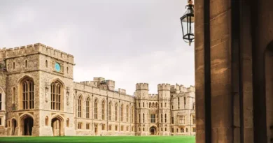
Get to Windsor Castle From Newcastle upon Tyne
Key Points
- The distance from Newcastle upon Tyne to Windsor Castle varies depending on the route taken: approximately 293 miles via A1(M) and M1, around 286 miles via A1(M), M1, and M25, and about 298 miles via A1(M).
- The fastest and most convenient option is by train, taking as little as 3 hours 44 minutes. This involves a train from Newcastle to London King’s Cross (around 2 hours 39 minutes), a short walk to the Underground, a quick tube ride to Paddington, and a direct train to Windsor via Slough.
- By car, the quickest route is via the A1(M) and M1, covering approximately 293 miles in around 5 hours and 15 minutes. Alternative routes via the M25 or M40 exist but offer similar travel times.
- Cycling is an option for the adventurous, taking roughly 28 hours over 320+ miles via National Cycle Routes 64 or 65.
- The best option depends on preference: train travel is the fastest and least stressful, driving allows flexibility, and cycling is for those seeking an endurance challenge.
Routes Comparison Table
| Travel Method | Route | Distance | Estimated Duration | Key Features | Considerations |
|---|---|---|---|---|---|
| Car | Route 1: Via A1(M) and M1 | 293 miles | ~5 hours 15 minutes | Fastest route avoiding congestion on A1 | Possible congestion on A1 and M1; no toll roads; potential road closures near Windsor Castle |
| Route 2: Via A1(M), M1, and M25 | 286 miles | ~5 hours 15 minutes | Slightly shorter than Route 1; uses M25 for better traffic flow | Can experience delays on M25; no tolls; potential road closures near Windsor Castle | |
| Route 3: Via A1(M) | 298 miles | ~5 hours 21 minutes | Uses M69 and M40 for an alternative motorway option | Longer than Routes 1 & 2; potential delays at motorway junctions; possible restricted access near Windsor Castle | |
| Train | Fastest Route (King’s Cross-Paddington-Slough-Windsor & Eton Central) | N/A | ~3 hours 44 minutes | Quickest train journey with a short walking transfer | Requires multiple transfers; depends on train schedules; Underground travel required |
| Alternative Route (Thameslink & Elizabeth Line via Farringdon) | N/A | ~4 hours 17-24 minutes | Avoids Underground; offers a bus option from Slough | Longer journey time; bus alternative increases travel time | |
| Later Departure Route (Slightly longer first segment) | N/A | ~4 hours 8 minutes | Similar to the fastest route but with a later departure | Longer journey time due to train schedule variations | |
| Cycle | Route 1: National Cycle Route 64 | ~326 miles | ~28 hours | Passes through historic towns like Market Harborough, Melton Mowbray, and Lincoln | Requires extensive endurance training; certain sections may have restricted access |
| Route 2: National Cycle Route 65 | ~323 miles | ~28 hours | Includes key locations such as York, Selby, and Hull | Similar restrictions as Route 64; significant elevation changes |
Getting to Windsor Castle from Newcastle upon Tyne by Car
Route 1: Via A1(M) and M1 (Fastest Route)
Travelling from Newcastle upon Tyne to Windsor Castle by car is a straightforward journey covering approximately 293 miles. Under ideal conditions, the journey takes around 5 hours and 15 minutes. The fastest route available, which avoids congestion on the A1, is Route 1: Via A1(M) and M1. Below is a step-by-step guide detailing the complete route to help ensure a smooth and efficient journey.
Step 1: Departing Newcastle upon Tyne
Begin your journey in Newcastle upon Tyne and follow these steps to reach the A1(M) in Birtley:
- Head west towards St Thomas’ Terrace (62 ft).
- Turn left onto St Thomas’ Terrace (292 ft).
- Turn left onto Leazes Lane (394 ft).
- Turn left onto Leazes Park Road (427 ft).
- Turn right onto Strawberry Place (0.2 mi).
- Turn left onto Gallowgate/A189 (262 ft).
- Turn right onto Gallowgate/St James’ Boulevard/A189 and continue following the A189 (1.0 mi).
- Slight right to stay on the A189 (0.3 mi).
- Continue onto the A184 (1.0 mi).
- Use the left two lanes to merge onto the A1 via the ramp to Durham/A167 (4.2 mi).
Step 2: Travelling on A1(M) and M1 to Slough
Once on the A1(M), follow these directions:
- Continue onto the A1(M) towards Durham (83.0 mi).
- Continue straight onto the M1 motorway (102 mi).
- Keep right to stay on the M1 (75.9 mi).
- At Junction 6A, use the third lane from the left to take the M25 exit towards M40/M4/Heathrow Airport (0.8 mi).
- Use the right lane to take the ramp onto the M25 (18.8 mi).
- At Junction 15, use the left two lanes to merge onto the M4 towards Slough (2.2 mi).
- Take the A4 exit towards Colnbrook/B470/Datchet/Langley (0.3 mi).
Step 3: Final Leg to Windsor Castle
To complete your journey from Slough to Windsor Castle, follow these steps:
- At Langley Roundabout, take the second exit onto Major’s Farm Road/B470 (1.7 mi).
- Take the second exit onto London Road/B376/B470 (210 ft) at the next roundabout.
- At the following roundabout, take the first exit onto High Street/B470 (0.2 mi).
- Turn right onto Windsor Road/B470 (1.4 mi).
- Turn left onto Thames Street/B3022 (0.2 mi). Note: Parts of this road may be closed at certain times or days.
- Turn left onto Castle Hill (266 ft) to reach Windsor Castle.
Key Considerations
- Traffic Conditions: The A1 and M1 are major motorways that can experience congestion, particularly during peak hours.
- Road Closures: Some roads around Windsor Castle, particularly Thames Street, may have restricted access on certain days.
- Toll Roads: There are no tolls on this route, but always check for updates on roadworks or diversions before departure.
By following this guide, your journey from Newcastle upon Tyne to Windsor Castle should be smooth and efficient, allowing you to arrive at your destination easily.
Route 2: Via A1(M), M1 and M25

This route covers a distance of approximately 286 miles and takes around 5 hours and 15 minutes under ideal driving conditions. Below is a detailed step-by-step guide on how to reach Windsor Castle from Newcastle upon Tyne using this route.
Stage 1: Exiting Newcastle upon Tyne
- Start your journey in Newcastle upon Tyne.
- Head west toward St Thomas’ Terrace (62 ft).
- Turn left onto St Thomas’ Terrace (292 ft).
- Turn left onto Leazes Ln (394 ft).
- Turn left onto Leazes Park Rd (427 ft).
- Turn right onto Strawberry Pl (0.2 mi).
- Turn left onto Gallowgate/A189 (262 ft).
- Turn right onto Gallowgate/St James’ Blvd/A189 and continue to follow A189 (1.0 mi).
- Slight right to stay on A189 (0.3 mi).
- Continue onto A184 (1.0 mi).
- Use the left two lanes to merge onto A1 via the ramp to Durham/A167 (4.2 mi).
Stage 2: Main Motorway Journey
- Continue onto A1(M) following signs for Durham (83.0 mi).
- Slight left to stay on A1(M) (10.7 mi).
- Continue onto A1 (7.7 mi).
- Continue onto A1(M), following signs for Red House/M18/M1 (7.7 mi).
- At Junction 35, take the M18 exit to Sheffield/M1/Scunthorpe/M180 (0.4 mi).
- At Wadworth Viaduct, take the 3rd exit onto the M18 ramp to Sheffield/M1 (0.6 mi).
- Merge onto M18 (6.9 mi).
- Use the right two lanes to take the exit toward M1/Nottingham (2.0 mi).
- Merge onto M1 (58.8 mi).
- Keep right to stay on M1 (75.9 mi).
- At Junction 6A, use the third lane from the left to take the M25 exit towards M40/M4/Heathrow Airport (0.8 mi).
- Use the right lane to take the ramp onto M25 (18.8 mi).
- At Junction 15, use the left two lanes to merge onto M4 towards Slough (2.2 mi).
- Take the A4 exit towards Colnbrook/B470/Datchet/Langley (0.3 mi).
Stage 3: Approaching Windsor Castle
- At Langley Roundabout, take the 2nd exit onto Major’s Farm Rd/B470 (1.7 mi).
- Take the 2nd exit onto London Rd/B376/B470 (210 ft) at the roundabout.
- At the next roundabout, take the 1st exit onto High St/B470 (0.2 mi).
- Turn right onto Windsor Rd/B470 (1.4 mi).
- Turn left onto Thames St/B3022 – note that parts of this road may be closed at certain times (0.2 mi).
- Turn left onto Castle Hill (266 ft).
You have now arrived at Windsor Castle.
By following this route, you can ensure a smooth and efficient journey from Newcastle upon Tyne to Windsor Castle. Safe travels!
Route 3: Via A1(M)

For those travelling from Newcastle upon Tyne to Windsor Castle by car, taking the A1(M) offers a direct and efficient route. Under ideal conditions, this journey takes approximately 5 hours and 21 minutes, covering a distance of around 298 miles.
1. Departing from Newcastle upon Tyne:
- Begin by heading west towards St Thomas’ Terrace (62 ft).
- Turn left onto St Thomas’ Terrace (292 ft).
- Turn left onto Leazes Lane (394 ft).
- Turn left onto Leazes Park Road (427 ft).
- Turn right onto Strawberry Place (0.2 mi).
- Turn left onto Gallowgate/A189 (262 ft).
- Turn right onto Gallowgate/St James’ Boulevard/A189 and continue following A189 (1.0 mi).
- Slight right to stay on A189 (0.3 mi).
- Continue onto A184 (1.0 mi).
- Use the left two lanes to merge onto A1 via the ramp to Durham/A167 (4.2 mi).
2. Continuing on A1(M) and M1 to Warwickshire:
- Continue on A1(M), following signs for Durham (83.0 mi).
- Slight left to stay on A1(M) (10.7 mi).
- Continue onto A1 (7.7 mi).
- Continue onto A1(M), following signs for Red House/M18/M1 (7.7 mi).
- At Junction 35, take the M18 exit towards Sheffield/M1/Scunthorpe/M180 (0.4 mi).
- At Wadworth Viaduct, take the 3rd exit onto the M18 ramp towards Sheffield/M1 (0.6 mi).
- Merge onto M18 (6.9 mi).
- Use the right two lanes to take the exit toward M1/Nottingham (2.0 mi).
- Merge onto M1 (58.8 mi).
- Take the exit towards M69 (0.2 mi).
- Use the right two lanes to take the M69 ramp towards Birmingham/Coventry (322 ft).
- At the roundabout, take the 3rd exit onto M69 towards Birmingham/M6/Coventry (16.4 mi).
3. Transitioning from M69 to M40:
- Continue onto Coventry Eastern Bypass/A46 (1.4 mi).
- Take the 1st exit at the roundabout and stay on Coventry Eastern Bypass/A46 (2.7 mi).
- Keep right to continue on Stonebridge Highway/A45 (1.5 mi).
- Use the left lane to take the ramp to A4114/City Centre (0.2 mi).
- At Stivichall Interchange, take the 1st exit onto the A46 ramp to M40/Banbury/Warwick/Leamington/A452/Kenilworth (0.3 mi).
- Continue onto Kenilworth Bypass/A46, following signs for Warwick (8.9 mi).
- Keep left to continue on Warwick Bypass (0.8 mi).
- At Longbridge Island, take the 2nd exit onto the M40 ramp towards London/Banbury/Leamington (0.5 mi).
4. Driving via M40 and A404 to Slough:
- Continue on M40 for 77.9 miles.
- Take the exit to M4, then follow A404 to A355 in Slough.
5. Final Stretch to Windsor Castle:
- Continue on A355 (0.5 mi).
- Continue onto Royal Windsor Way/A332 (1.2 mi).
- Slight left onto Clarence Road, passing through one roundabout (0.5 mi).
- Continue onto Victoria Street (0.3 mi).
- Take the 1st exit onto Sheet Street/B3022 at the roundabout and follow the B3022 (0.2 mi). Note: Parts of this road may be closed at certain times.
- Turn right onto Castle Hill (266 ft) to reach Windsor Castle.
This route ensures a smooth drive from Newcastle upon Tyne to Windsor Castle, taking advantage of major motorways and bypasses to minimise travel time.
Getting to Windsor Castle from Newcastle upon Tyne by Train
Travelling from Newcastle upon Tyne to Windsor Castle by train involves multiple routes and varying journey times. The total travel duration depends on factors such as waiting times between connections, the number of stops, and the mode of transport used for the final leg of the journey.
Travel Duration
The journey from Newcastle to Windsor Castle can take approximately 3 hours 44 minutes to 4 hours 24 minutes, depending on the chosen route. The variance in travel time is due to differences in waiting times between transfers, the number of stops on each segment, and whether a bus is used for the final stretch.
Common Route Features
All routes begin with a train journey from Newcastle to London King’s Cross, which takes around 2 hours 39 minutes to 3 hours 4 minutes, depending on the specific service. This segment usually includes three to six stops en route to London. Once at King’s Cross, passengers must transfer to a different form of transport to continue towards Windsor.
Variations in Routes
- Fastest Route (Approximately 3 hours 44 minutes)
- This route involves a 5-minute walk from King’s Cross to the Underground.
- A 12-minute subway ride (Circle or Hammersmith & City line) takes passengers to Paddington.
- A 15-minute direct train from Paddington to Slough follows.
- A final 6-minute train from Slough to Windsor & Eton Central completes the journey.
- Walking from the station to Windsor Castle takes approximately 7 minutes.
- Alternative Route via Thameslink and Elizabeth Line (4 hours 17 minutes – 4 hours 24 minutes)
- Instead of taking the Underground, passengers take a 4-minute Thameslink train from St Pancras to Farringdon.
- From Farringdon, the Elizabeth Line train takes 38 minutes to reach Slough.
- One variation of this route involves taking a bus from Slough (16 minutes) instead of the train, leading to a total journey time of 4 hours 17 minutes.
- Another variation takes the 6-minute train from Slough to Windsor & Eton Central, extending the journey to 4 hours 24 minutes.
- Later Departure Route (4 hours 8 minutes)
- A later train from Newcastle extends the first segment to 3 hours and 4 minutes.
- The rest of the route mirrors the fastest option but results in a slightly longer total journey time.
Why the Travel Times Differ
- Connection Wait Times: Some routes have longer waiting times between connections, such as waiting for the next train at Slough or Farringdon.
- Number of Stops: Certain trains make more stops, increasing travel time.
- Final Leg by Bus vs. Train: The choice between taking a bus from Slough or continuing via train impacts the total journey duration.
- Time of Departure: Later trains may have longer journey times due to different stopping patterns or reduced frequency of connecting services.
Travellers should consider their preferred balance between speed and convenience when selecting their route to Windsor Castle.
Getting to Windsor Castle From Newcastle upon Tyne By Cycle
Embarking on a cycling journey from Newcastle upon Tyne to Windsor Castle is an ambitious endeavour, covering over 320 miles and requiring approximately 28 hours of continuous riding. The National Cycle Network offers two primary routes for this expedition:
Route Options:
- Via National Cycle Route 64:
- Distance: Approximately 326 miles
- Elevation Gain/Loss: 6,959 feet ascent and 7,034 feet descent
- Elevation Range: From a minimum of 3 feet to a maximum of 1,257 feet above sea level
- Estimated Duration: Around 28 hours of cycling
- Notable Considerations: Certain sections may have restricted usage or traverse private roads, necessitating prior planning and permissions.
- Key Locations Along the Route:
- Market Harborough: A picturesque town marking the starting point of Route 64.
- Melton Mowbray: Renowned as the home of the pork pie, this town offers a historic farmers’ market dating back to 1077.
- Newark-on-Trent: A historic market town featuring the Newark Castle and a rich Civil War history.
- Lincoln: Known for its magnificent cathedral and medieval architecture, Lincoln provides a scenic endpoint for Route 64.
- Via National Cycle Route 65:
- Distance: Approximately 323 miles
- Elevation Gain/Loss: 7,090 feet ascent and 7,162 feet descent
- Elevation Range: From a minimum of 3 feet to a maximum of 1,257 feet above sea level
- Estimated Duration: Also around 28 hours of cycling
- Notable Considerations: Similar to Route 64, this path includes segments with restricted usage or private roads.
- Key Locations Along the Route:
- York: A historic city famed for its well-preserved medieval walls, the iconic York Minster, and the charming Shambles Street.
- Beningbrough Hall: An 18th-century baroque mansion with impressive gardens located near the village of Shipton.
- Selby: Home to the Selby Abbey, a notable example of medieval architecture.
- Hull: A port city with attractions like the Humber Bridge and the Deep Aquarium.
Important Considerations:
- Route Restrictions: Both routes incorporate sections with limited access or private pathways. Researching these areas in advance and obtaining necessary permissions or identifying alternative paths is essential to ensure a seamless journey.
- Elevation Challenges: The routes present significant elevation changes, with ascents and descents exceeding 6,900 feet. Adequate physical preparation and endurance training are advisable to tackle these challenges effectively.
- Time Commitment: The estimated cycling time is approximately 28 hours. Planning for rest stops, overnight accommodations, and meal breaks will contribute to a safer and more enjoyable experience.
Embarking on this cycling trip requires meticulous planning and preparation. By considering the factors outlined above and exploring the notable locations along each route, you can look forward to a rewarding adventure from Newcastle upon Tyne to the historic Windsor Castle.
Conclusion
The journey from Newcastle upon Tyne to Windsor Castle offers multiple travel options, each with its own advantages. Driving provides a direct and flexible route, with the A1(M) and M1 offering the fastest journey in around five hours. Train travel, while requiring transfers, can take as little as 3 hours 44 minutes, making it an efficient alternative. For the adventurous, cycling the 320-mile route is a challenging yet rewarding endeavour, showcasing scenic landscapes and historic landmarks along the way. Regardless of the chosen mode of transport, proper planning ensures a smooth and enjoyable trip to this iconic destination.


